
Isla de las Palomas
The island off Tarifa is a strictly protected part of the natural park on the Strait.
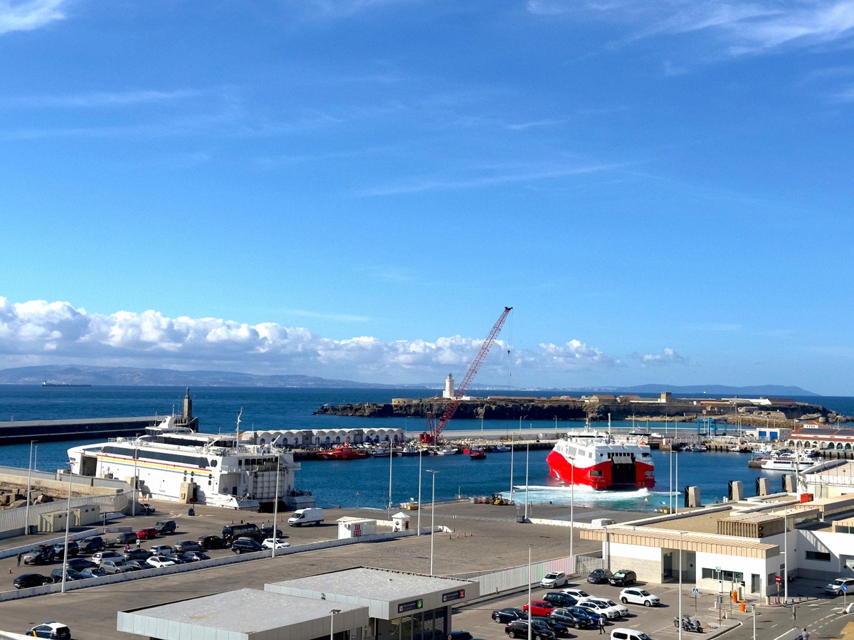
Isla de las Palomas, also called Isla de Tarifa, is part of the Parque Natural del Estrecho and access is restricted. At its tip lies Punta Marroquí, the southernmost point of the Iberian Peninsula. The island is home to the Faro de Tarifa lighthouse, military gun batteries from different periods and medieval quarries.
On this page
An island on the Strait
Isla de las Palomas, also called Isla de Tarifa, rises from the sea as a sizeable islet off Tarifa on the Strait of Gibraltar. At its tip lies Punta Marroquí, the southernmost point of the Iberian Peninsula. For its natural, cultural and historical value, the island is regarded as the jewel in the crown of the Parque Natural del Estrecho. It is highly protected and therefore little known.
Plants, birds and the natural park
Protected plants grow on the island, such as the sea lavender species Limonium emarginatum, known in Spanish as siempreviva del Estrecho. It is endemic to the Strait of Gibraltar and found nowhere else. The island is also home to many waterbirds.
The Parque Natural del Estrecho was designated on 21 March 2003. It covers 19,177.29 ha in the municipalities of Algeciras and Tarifa and more than 60 km of coastline, and about half of its area is at sea. The sea off the coast from Isla de Tarifa to Cabo de Gracia is part of the park up to one nautical mile offshore. Since 2006 it has been part of the Intercontinental Biosphere Reserve of the Mediterranean, a UNESCO designation.
Quarries, gun batteries and lighthouse
A marked path across the island leads to medieval quarries, military gun batteries from various periods and the Faro de Tarifa lighthouse. A visitor centre has been set up in the restored annexe of the lighthouse, the former lighthouse keepers' quarters. Under the title “La Isla de Tarifa. Testigo de la Historia del Estrecho”, it covers five themes: the Strait as a crossroads, the seabed around the island, the island's history, the island as a stronghold and the lighthouse.
Access and information
Access to Isla de las Palomas is restricted. For the visitor centre, ask at the Oficina Municipal de Turismo on the Paseo de la Alameda in Tarifa.
The view from the mainland
From the viewpoint in the Castillo de Guzmán el Bueno you look out over the port and the island. Opposite the island, on Punta de las Palomas a few metres from the port, stands the Castillo de Santa Catalina, 24 m above the sea. In 1972 the navy converted it into a control centre for shipping in the Strait of Gibraltar, and since 2001 it has belonged to the town again.
Migrating whales and dolphins have to pass through the Strait; more under Whales and dolphins. The crossing from the port to Morocco is described on the Tarifa - Tangier ferry page. On land are the castle and the old town with the Puerta de Jerez, and more places to visit are in Things to do.